The Santorini Caldera: What It Is and Where to See It
The thing everyone photographs is a hole in the sea where a mountain used to be. Understanding what happened here, and it is one of the largest eruptions in human history, makes the view considerably better than treating it as a nice cliff.
SANTORINI · MARINAKIS TOURS
The answer, at a glance
What is the Santorini caldera?
A collapsed volcanic basin, now flooded by the sea. Around 1600 BC the volcano erupted catastrophically, the summit collapsed inward, and the Aegean filled the void. The cliffs you see are the rim of that collapse.
How deep is the Santorini caldera?
Up to about 400 metres below sea level, with rim cliffs rising as much as 300 metres above it. The flooded basin measures roughly 12 km by 7 km.
What a caldera actually is
A caldera is not a crater. A crater is blown outward by an explosion; a caldera collapses inward when the magma chamber beneath a volcano empties faster than it can be refilled, and the roof falls into the void.
That is what happened here. Around 1600 BC, Santorini, then a roughly circular island called Thera, erupted catastrophically. The eruption ejected somewhere in the order of 60 cubic kilometres of rock and ash, the summit collapsed, and the Aegean poured into the space where a mountain had been.
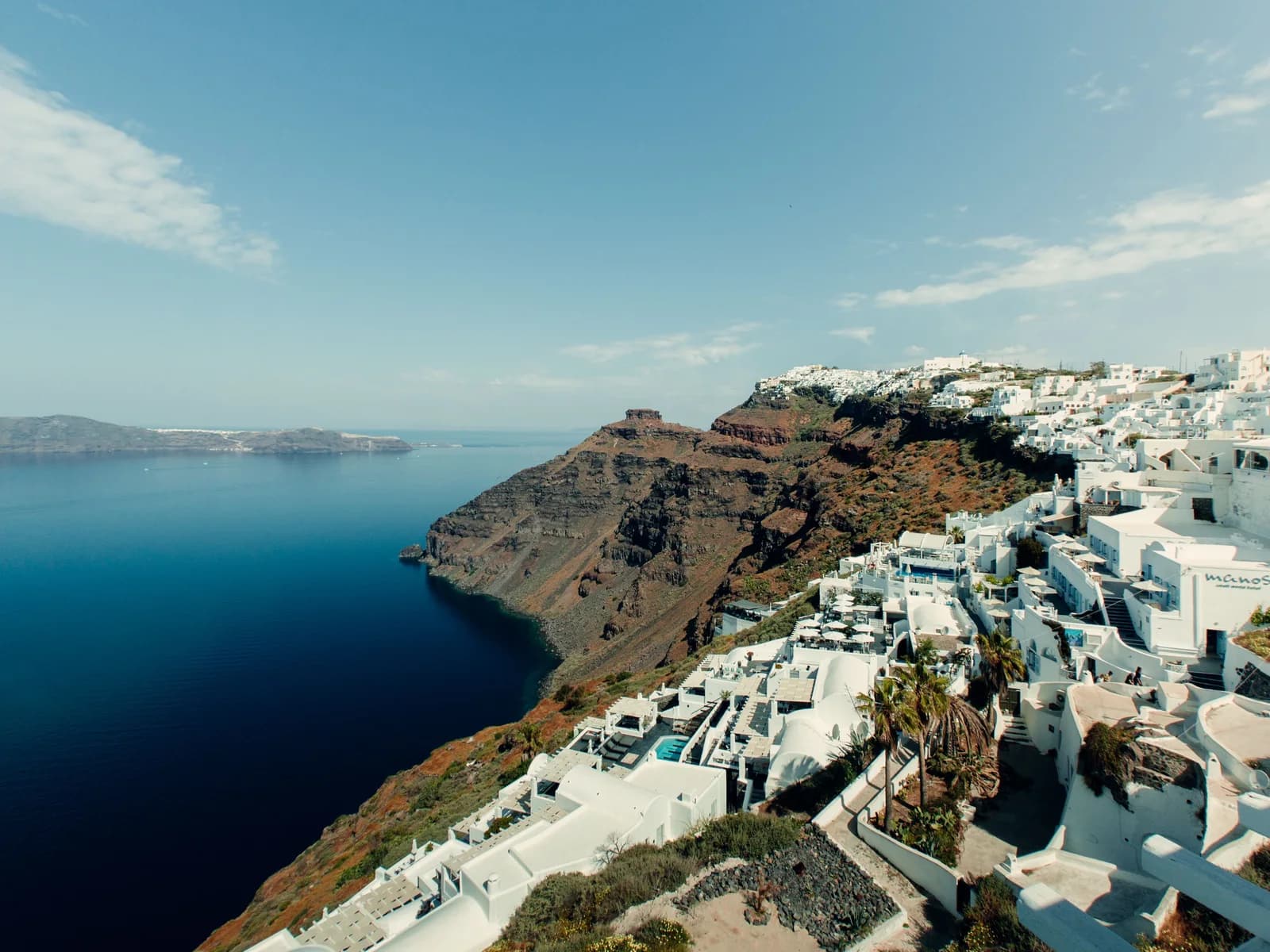
What you see today is the rim of that collapse: a ring of cliff up to 300 metres high, enclosing a flooded basin roughly 12 km by 7 km and up to 400 metres deep. Thirassia, the small island across the water, is part of the same rim. The dark islets in the middle, Nea Kameni and Palea Kameni, are newer lava domes that have grown out of the crater floor since.
- Eruption dated to roughly 1600 BC, among the largest in recorded human history
- Rim cliffs rise up to ~300 m; the flooded basin reaches ~400 m deep
- Thirassia is part of the same collapsed rim
- Nea Kameni and Palea Kameni are post-collapse lava domes
- The volcano is dormant and continuously monitored
Why the cliff is striped
Look closely at the caldera wall and you will see horizontal bands, red, black, grey, and a thick pale layer near the top.
Each band is an eruption. The dark bands are lava flows and scoria from earlier cycles; the red comes from oxidised iron. The pale layer capping the whole thing is the ash and pumice from the 1600 BC event itself, and in places it is tens of metres thick.
That white layer is also why the island's architecture looks the way it does. The soft pumice could be dug out by hand, which is how the original cave houses, the *yposkafa*, were made: excavated into the cliff rather than built on it. The whitewashed cave hotels selling caldera views today are a refinement of houses that were dug because digging was easier than building.
The best places to see it
The whole west-facing side of the island is a viewpoint, but they are not equivalent.
- Imerovigli and the path to Skaros Rock give the clearest sense of the collapse
- Pyrgos is inland and high, the only place you see both coasts at once
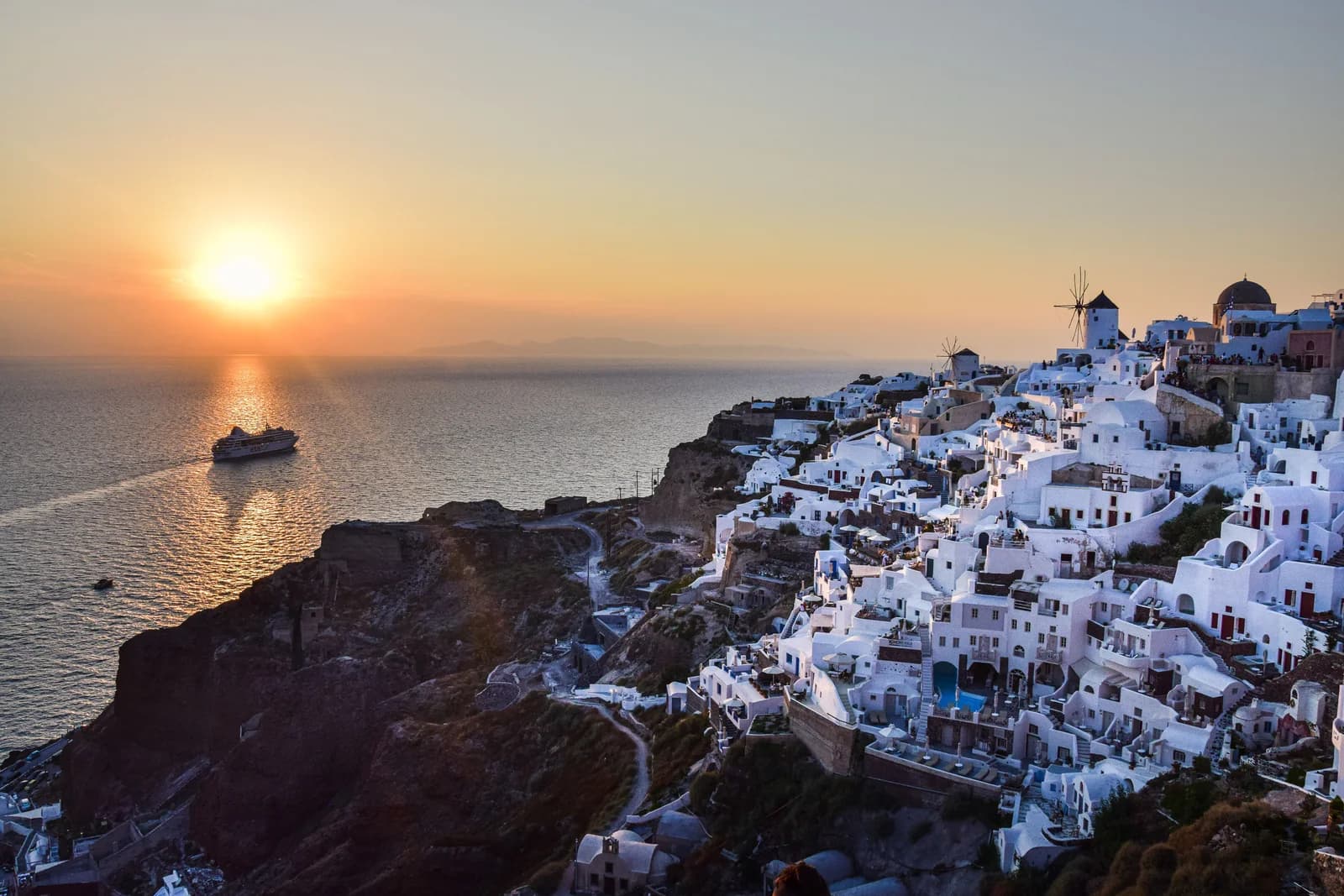
- Oia is the famous frame and is genuinely crushed from about 17:00
- Firostefani is the best value-for-effort viewpoint on the rim
| Viewpoint | What you get | Crowds |
|---|---|---|
| Oia castle | The classic sunset frame | Extreme after 18:00 |
| Imerovigli / Skaros | Highest rim point, best geology | Low |
| Firostefani | Fira's view without Fira's noise | Low–moderate |
| Fira cliff path | Wide basin view, cable car below | High on cruise days |
| Pyrgos castle | Whole-island panorama, inland | Low |
| From the water | The only view of the cliff as a whole | None |
See it from the inside
Standing on the rim you cannot see the thing you are standing on. From the water in the middle of the basin, the scale becomes obvious in a way no clifftop view manages, 300 metres of striped rock curving away on three sides, with the villages reduced to a white line along the top.
A catamaran cruise crosses the basin, stops for snorkelling at Red and White Beach and at the hot springs off Palea Kameni, and returns past Oia. Volcano boats land on Nea Kameni itself, where a 30 to 45 minute walk up loose scree brings you to the crater rim of the active cone.
If you do one thing on Santorini beyond looking at sunsets, make it getting out onto the water. It is the difference between seeing a view and understanding a place.
Is the volcano dangerous?
Not currently, and it is watched extremely closely.
The Santorini volcano is dormant rather than extinct. Its last eruptive activity was at Nea Kameni in the 1950s, and there was a period of measurable unrest around 2011–2012 that resolved without incident. The Institute for the Study and Monitoring of the Santorini Volcano maintains continuous instrumentation across the caldera, and the island sits within Greece's national seismic monitoring network.
The 1600 BC eruption almost certainly devastated Minoan settlements across the region and buried the town at Akrotiri, which is why that site is so well preserved, and it is the reason Santorini is tied, speculatively, to the Atlantis legend. That was three and a half thousand years ago. Visiting today carries no meaningful volcanic risk.
Akrotiri: the town the eruption buried
The best single piece of context for the caldera is not a viewpoint at all, it is the archaeological site at Akrotiri, on the island's southwestern tip.
A Bronze Age town was buried under metres of volcanic ash by the eruption and preserved almost intact: two- and three-storey buildings, drainage systems, staircases, frescoes, storage jars still in place. It is often compared to Pompeii, though it predates it by roughly 1,700 years, and unlike Pompeii no human remains have been found, the inhabitants appear to have had warning and left.
The site is roofed, shaded and walkable, which makes it one of the few genuinely comfortable things to do in Santorini in August. Seeing the town first and the caldera afterwards puts the cliff in a very different light.
Domande utili. Risposte chiare.
What is the Santorini caldera?
A collapsed volcanic basin, now flooded by the sea. Around 1600 BC the volcano erupted catastrophically, the summit collapsed inward, and the Aegean filled the void. The cliffs you see are the rim of that collapse.
How deep is the Santorini caldera?
Up to about 400 metres below sea level, with rim cliffs rising as much as 300 metres above it. The flooded basin measures roughly 12 km by 7 km.
Is the Santorini volcano still active?
Dormant, not extinct, and continuously monitored. The most recent eruptive activity was at Nea Kameni in the 1950s. There is no meaningful risk to visitors.
Where is the best view of the caldera?
Imerovigli and the path to Skaros Rock give the clearest sense of the geology; Oia is the classic sunset frame but extremely crowded; Pyrgos offers a whole-island panorama from inland. The best view of all is from a boat in the middle of the basin.
Why are the caldera cliffs striped?
Each band is a separate eruption layer. Dark bands are lava and scoria, red comes from oxidised iron, and the thick pale cap is ash and pumice from the 1600 BC eruption itself.
Is Santorini connected to the Atlantis legend?
Speculatively. The 1600 BC eruption destroyed a sophisticated Bronze Age civilisation at Akrotiri and disrupted Minoan Crete, and some scholars see that as a plausible source for Plato's account. It is a hypothesis, not established fact.
Can you visit the volcano in the middle of the caldera?
Yes. Boats land on Nea Kameni, from where a 30–45 minute walk up loose volcanic gravel reaches the crater rim. Wear closed shoes and carry water, there is no shade at all.